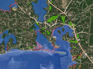
The Commission's GIS Open Data Portal provides access to all operational GIS data. The portal is a public platform for exploring and downloading open data, discovering and building apps, and engaging to solve important local issues.
Users can access boundaries, such as parcels and historic areas; planimetric data, including buildings and surface features; and water-related data, like projected sea level rise and wetlands.
Contact
-
Anne Reynoldsareynolds@capecodcommission.org