Cape Cod Commission creates online Pond Viewer
New online tool provides an in-depth look at Cape Cod's ponds and lakes
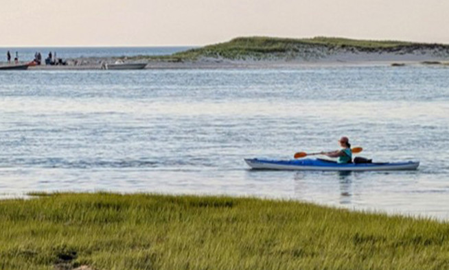
In 2021, Cape Cod Commission staff completed an update to the Cape Cod Pond and Lake Atlas and developed an online Pond Viewer as a companion tool to the updated Atlas. The Viewer and Atlas may be used together to explore Cape Cod’s ponds, ecology, and the challenges they face.
The 2021 Pond and Lake Atlas explores the characteristics, value, and threats of Cape Cod’s ponds. The Pond Viewer complements the report and findings by providing visual and easily accessible pond data and information. It allows the presentation of available data for all 890 ponds and enables users to view a pond of interest within the local/regional context. The Pond Viewer will be updated to reflect the best available data and information.
Created by Cape Cod Commission staff
Cape Cod Commission staff created the Pond Viewer using ESRI’s ArcGIS mapping and analytics software. Newer and more refined resolution data provided an opportunity to assess our region's ponds' definition carefully. For the Pond and Lake Atlas, ponds were defined as freshwater bodies over 10,000 square feet in size. Better aerial photography allowed staff to confirm whether a feature was consistently an open water body or a wetland. Staff referenced state and national wetlands data layers to support this assessment. With a revised number of ponds identified for the Atlas update, the team began to build the pond layer leveraging the Commission’s detailed planimetric data.
Cape Cod Commission staff built a custom base map for the application that enhances the view of ponds across the region. Staff gathered or created various supporting layers, including pond watershed boundaries, access points, bathymetry, and buffer analyses. These new analyses provide a unique snapshot of potential impacts on every regional pond resource.
Explore the data online
Exploring the pond viewer can provide a better understanding of the setting of ponds in the local and regional context. Users can log on to the pond viewer to locate and learn about ponds across the Cape, whether they are named or nameless, large or small.
A pop-up window for the selected pond includes its name, location details, pond acreage, depth, and percent of protected open space in the pond's 300-foot buffer. Users will also find information such as Great Pond status, connection to a cranberry bog, availability of watershed delineation, and fish stocking.
The Ponds Viewer allows users to explore the makeup of surrounding land cover and land use within the 300-foot buffer of the pond by clicking sections of two pie charts. Users can select layers, including pond watershed, pond bathymetry, 300-foot buffers, pond access, and buffer land use and land cover.
When selected, pond access points provide information about the pond's location, number of available parking spots, operational days and hours, and various amenities that may be available, such as boating, restrooms, hiking, and picnicking options.
A viewer for all types of users
The information available in the Ponds Viewer may be used broadly by residents, pond and water quality advocates, town officials, and others making decisions about pond management.
As additional information and analysis become available, the pond viewer and the database that supports it may serve as a means for categorizing and prioritizing ponds for action or as a starting point for additional study and analysis. Pond relationships based on shared coastal watersheds, linkages by streams or wetlands, or within groundwater lenses may play a role in addressing pond water quality and its role in broader efforts to address groundwater or marine water quality.
Explore the data: Cape Cod Pond Viewer
Related Posts